Review of Class 3
Thematic Mapping
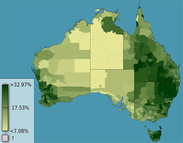
What does the term choropleth mean?
What does the term choropleth mean?

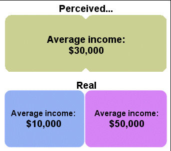
What is an Ecological Fallacy?
What is an Ecological Fallacy?
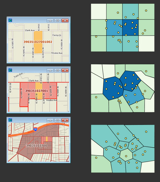
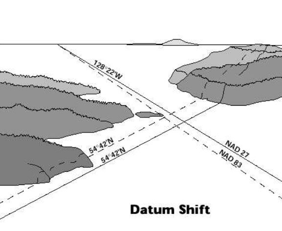
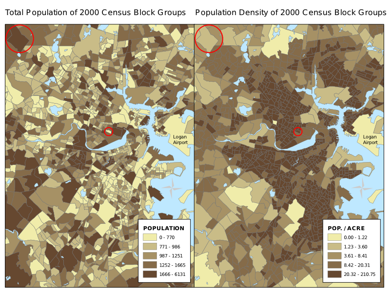
What problem is notated on the left, and how is it fixed on the right?
Class 4
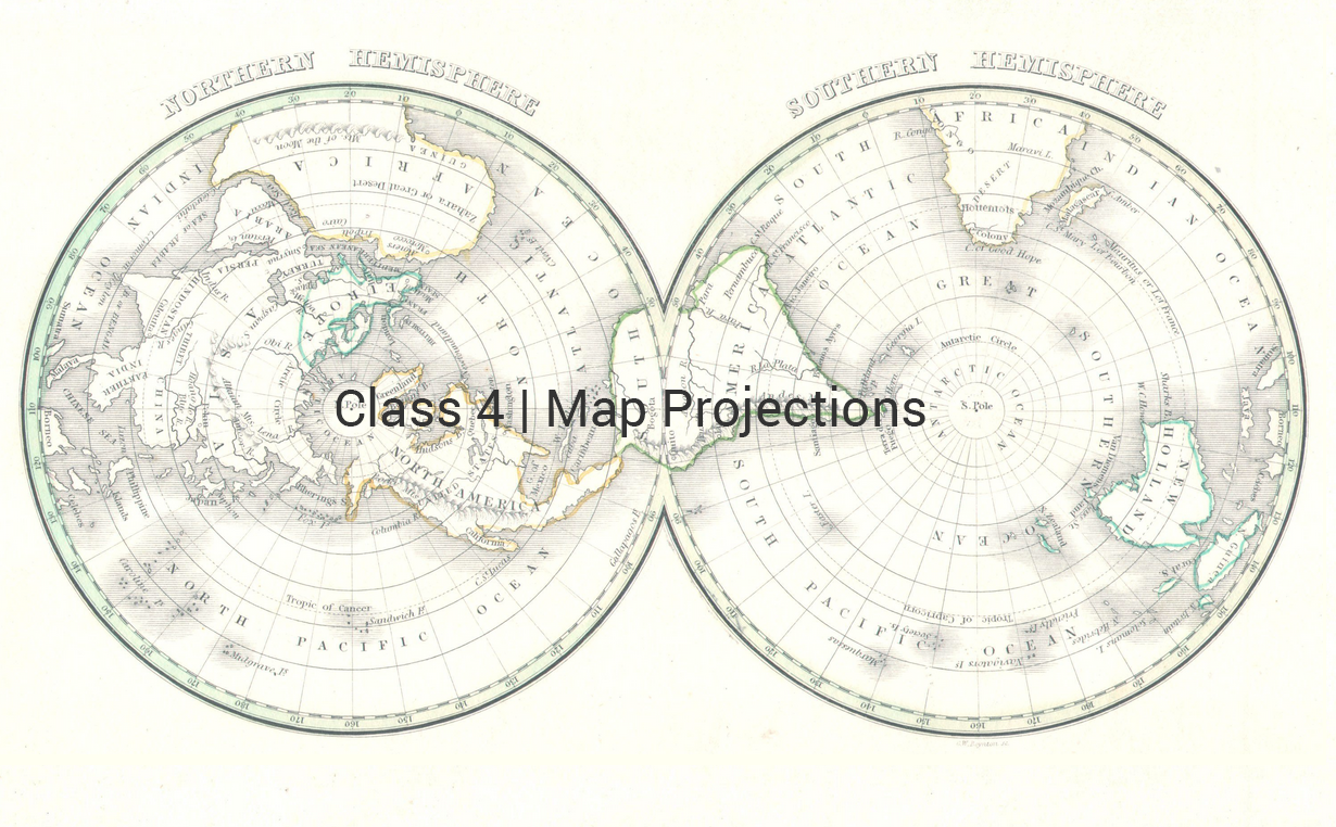
Map Projections
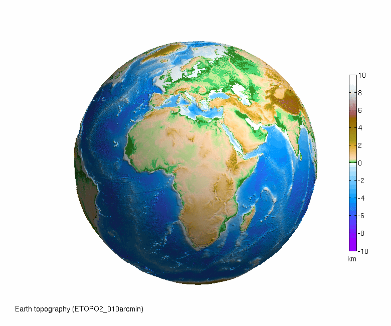
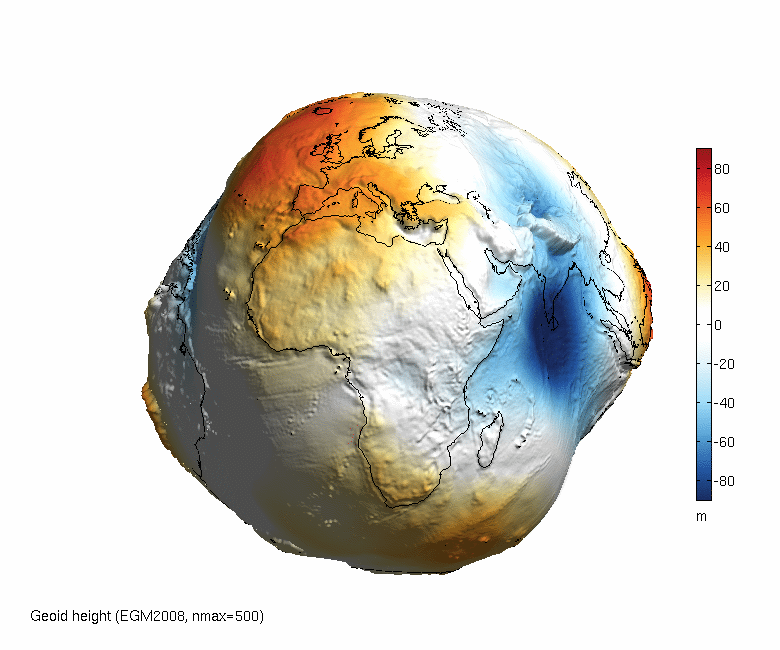
A "Developable Surface" it is not....


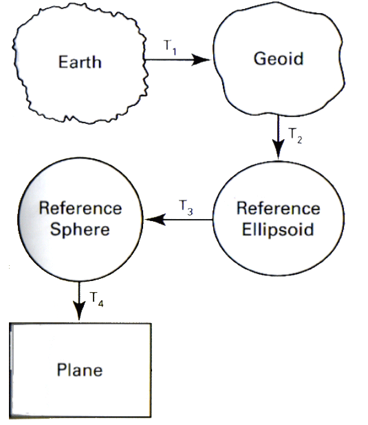
To get to a 'Flat Map' we have to go through a series of progressive steps
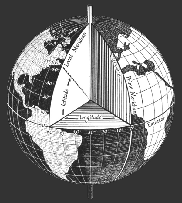
= Earth > Geoid > Ellipsoid > Reference Sphere > Plane
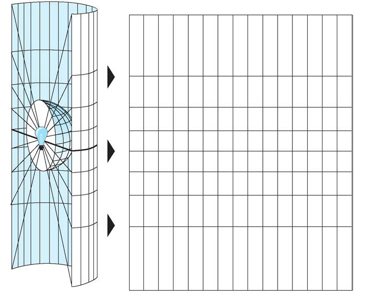
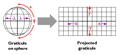
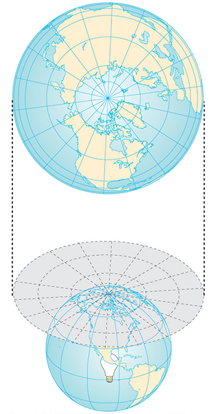
How to get to Planar from Sphere?
Use a lightbulb!
What happens to the map units when transforming from GCS to PCS?
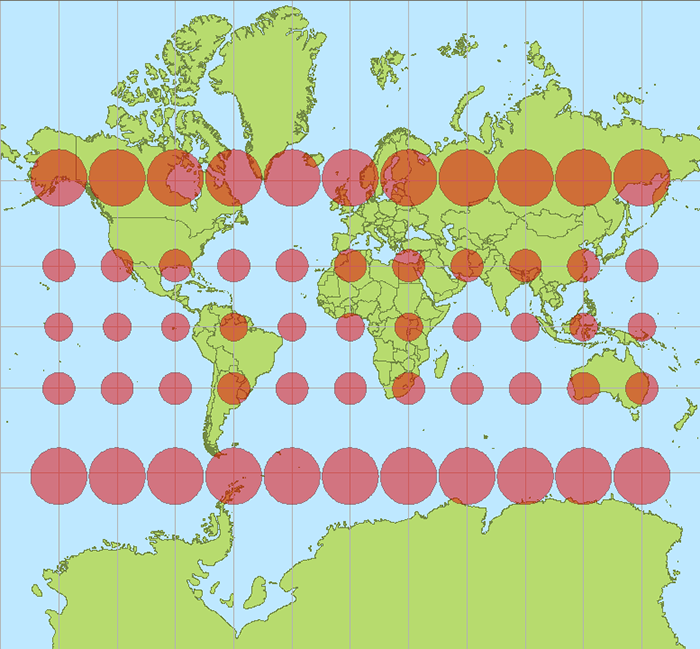
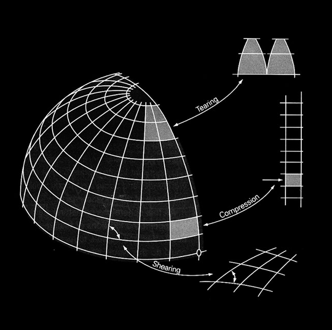
A painful process...resulting in geometric distortions
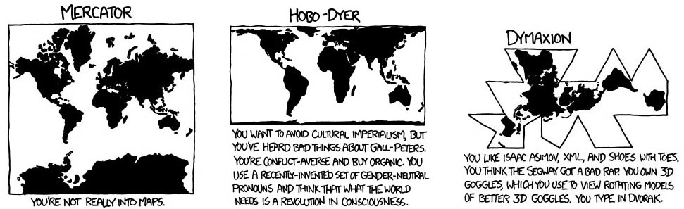
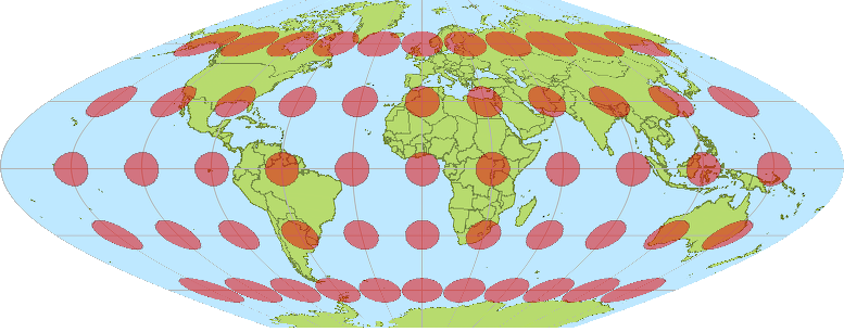
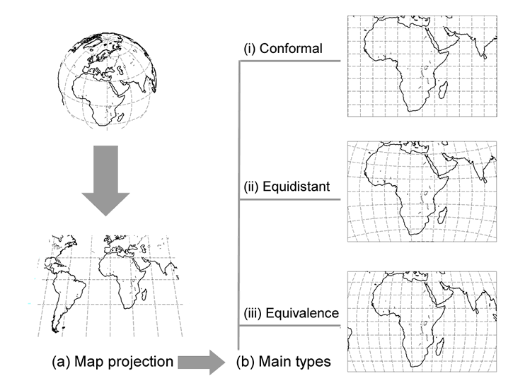
Different Projection Systems are good at some things, and bad at others....
Preserving direction (azimuthal or zenithal), a trait possible only from one or two points to every other point
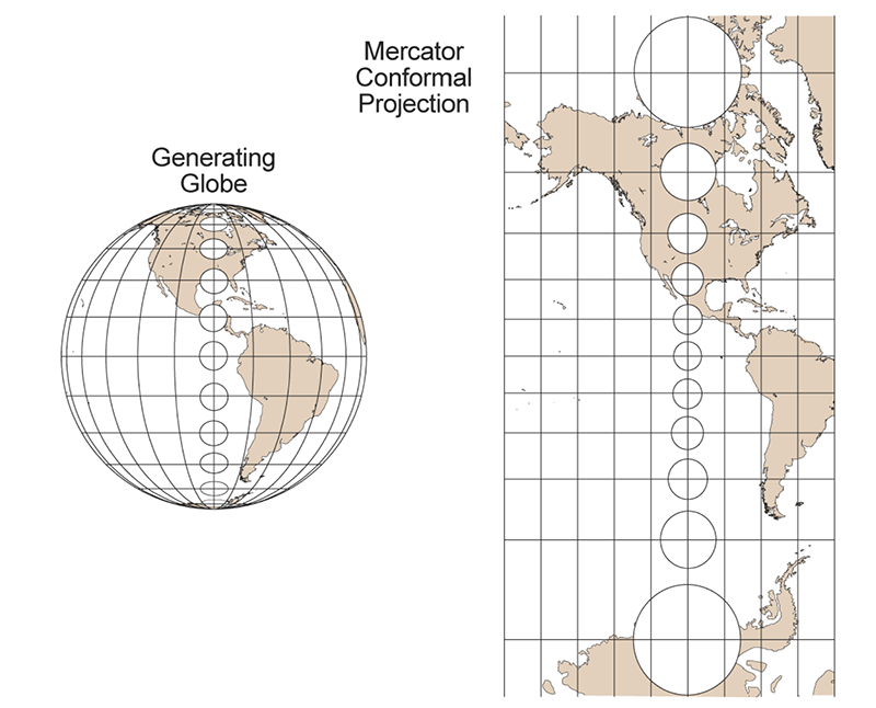
Preserving shape locally (conformal or orthomorphic)
Preserving area (equal-area or equiareal or equivalent or authalic)
Preserving distance (equidistant), a trait possible only between one or two points and every other point
Preserving shortest route, a trait preserved only by the gnomonic projection
Projections fall in to the 'family' groupings; each 'family' typified by what they preserve...
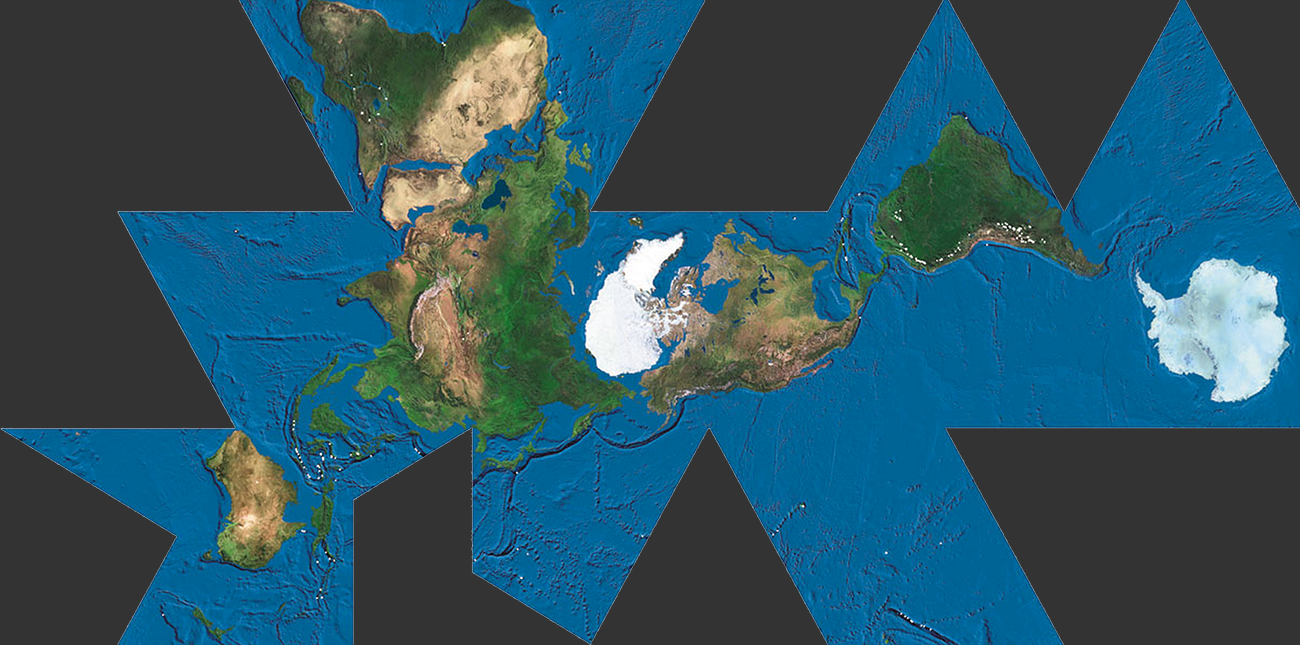
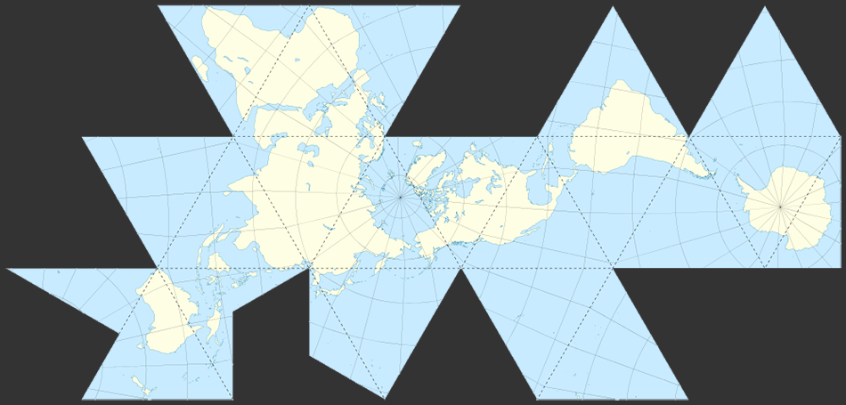
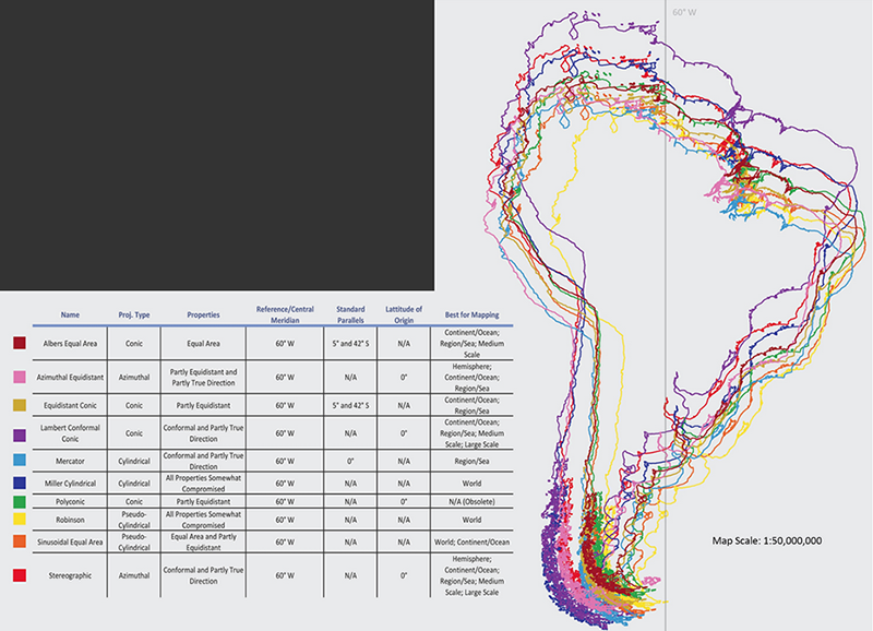
Comparison of Map distortion @ South America
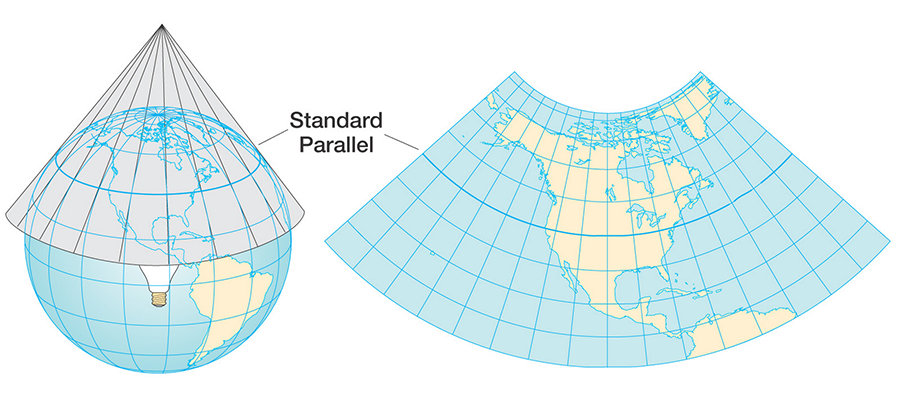
Projections are also grouped based on their 'Projection Surfaces' ...
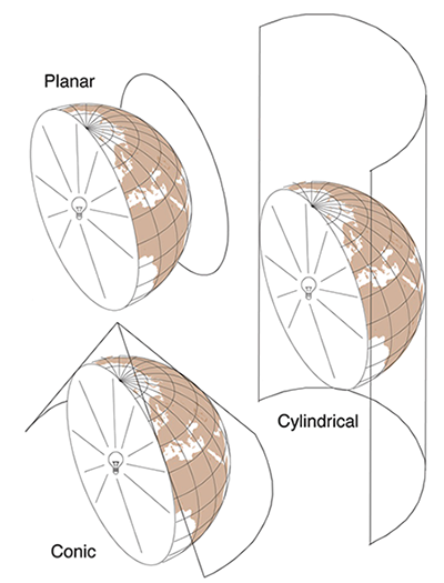
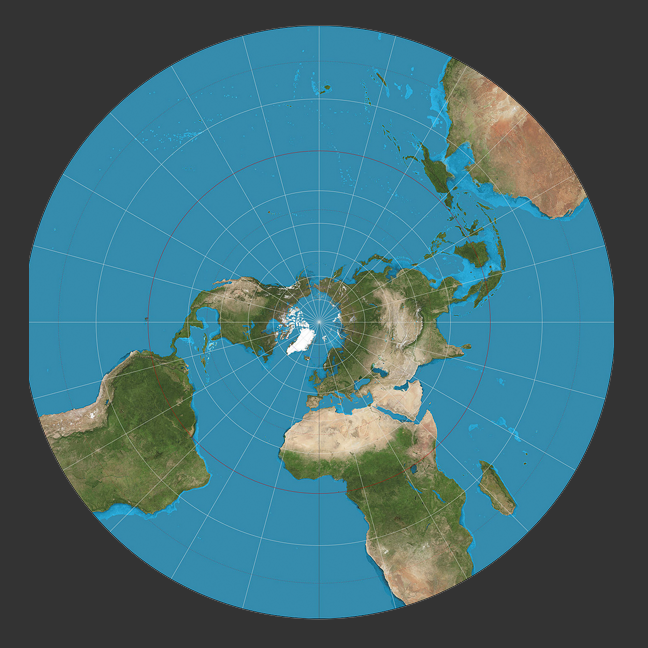
A good example of a planar projection is a polar stereographic projection...
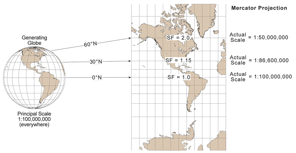
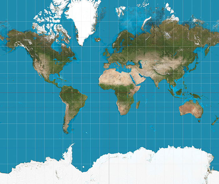
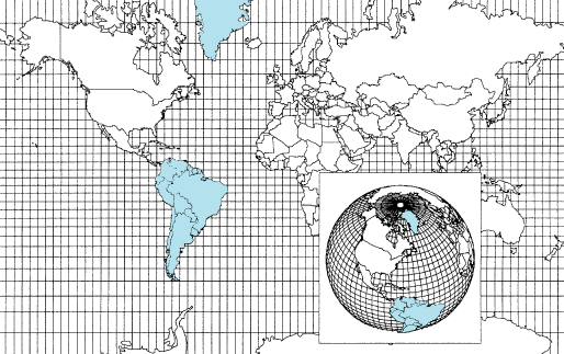
A good example of a cylindrical projection is - of course - the Mercator Projection...

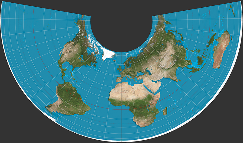
A good example of a conic projection is an Albers Equal Area Projection often used for USA...
Map Projections
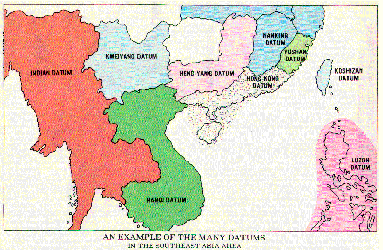
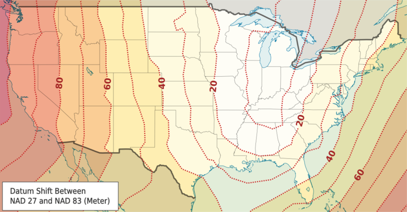
Datums & Coordinate Systems
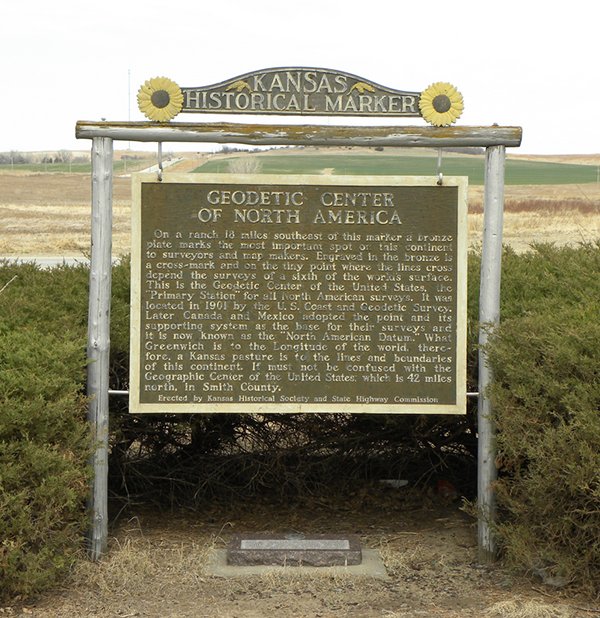
'Center' of North America- Meades Ranch, Kansas | NAD27
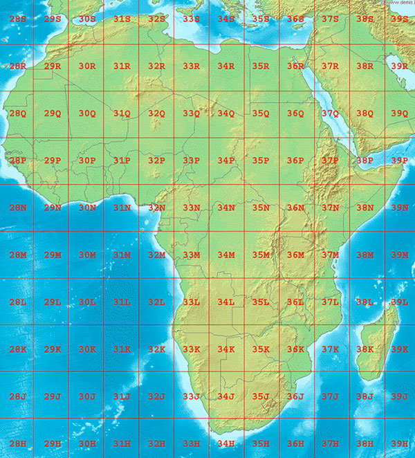
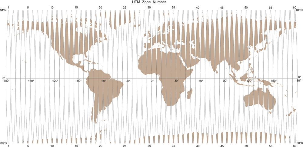
Best known grid system of international scope = UTM
Map Projections
Break | Lab